

I. INTRODUCTION
Bali is an island in the Indonesian archipelago which 98% of its population is Balinese Hindu (DHV, 1996). For decades the island has fascinated the world with its vibrant culture born in deeply rooted cults of ancient tradition and fostered by the guiding rituals of a strong religion. As such, religion is to the Balinese their law, the force that holds the community together. It is the greatest stimulus of their lives because it has given them their ethics, culture, wisdom, and joy of living by providing the exuberant festivity they love. It is logical that any space manipulation activity - in building or spatial design - will utilize some traditional-religious conceptions of space.
Spatial planning and design in Bali is fundamentally relied on the religious philosophy of Balinese Hinduism in which the five basic elements of Panca Manabhuta and three elements of life, atma, angga, and prana', are harmoniously interplaying within the relationship between nature/environment or living space (bhuwana agung or macrocosm) and human being (bhuwana alit or microcosm) as a whole unit of life. In this respect, philosophically the relationship is also referred to 'baby (represents the microcosm) in the mother's womb (represents the larger cosmos)' or 'manik ring cucupu". Such a philosophy is also known as the psycho-cosmic concept in the Bali Hindu teachings (Samadhi, 2001b,c).
In a human settlement those elements of life are materialized in the form of Tri Kahyangan temples (atma), wawidangan or territory (sarira) and sima krama or the settlement dwellers (prana). Subsequently this concept was named Tri Hita Karana2 and inspired the formulation of Tri Angga which qualitatively structures a space into utama angga (sacred, upstream), madya angga (neutral, middle) and nista angga (profane, downstream). The philosophy of Tri Hita Karana can also be perceived as the underlying grouping of spatial uses within a cosmological unit of territory, that is parahyangan (sacred spaces, e.g. pura or temple), pawongan (middle spaces, occupied by the unit dwellers' settlement), and palemahan (profane spaces, e.g. cemetery).
The spatial structuring of Tri Angga defines the settlement patterns of linear, crossroad (pampatan agung) and combination between these two. The settlement functions (marketplace, palace, open space, etc.), then, were laid out around the patterns in accordance to those philosophical foundations, spatial structuring system and orientation conceptions such as Kaja Kelod<sup>3</sup> and Kangin-Kauh<sup>4</sup>. The pattern by which those functions were arranged is conceptually known as Sanga Mandala (literally means 'nine-folded hierarchical space). However, such arrangement will differ in its detail according to the operative local knowledge system including the Tri Pramana ('placetime situation' dictum) and Tri Masa ('past-present-future' dictum) principles.
There are seven Bali Hindu conceptions of space and their core-periphery continuum order that reflects their degree of importance in the contemporary Balinese spatial formation (Samadhi, 2001b). Those conceptions are 1) psycho-cosmic concept; 2) Tri Hita Karana; 3) Tri Angga; 4) Kaja-Kelod; 5) Kangin-Kauh; 6) Sanga Mandala; and 7) local knowledge systems (Tri Pramana and Tri Masa). With this background of the Balinese traditional-religious conceptions of space and a set of Balinese urban design objectives proposed by Samadhi (2001a, b) which will be elaborated below. it should be possible to evaluate the landscape design approach taken in the Regency of Badung Civic Center (Bali) planning project carried out by the Badung Regency Planning Board in conjunction with PT TLU Engineering Consultant in 1997.
II. THE BALINESE URBAN DESIGN OBJECTIVES<sup>5</sup>
The comprehension of the physical organization of a city form combines four closely interrelated, but distinct, functions of access, compatibility, identity and livability (Samadhi, 2001 a, b; c.f. Lynch, 1981; Bentley et. al, 1985; Tibbalds, 1988). Therefore, the elaboration of the Balinese urban design objectives will take advantage of this categorization. In its original concept, the objectives are aimed at addressing the design process of an urban area with a characteristic of a desa adat, hence uniquely Balinese settlement unit. In this paper, it will be modified such that can be utilized in addressing the design of a special area such as a civic center.
Access: Design Objective No. 1
To create a town form - composed of cosmic territorial units (desa adat) such that will provide an emphasize on the routes and spots of the Balinese Hindu ritual purposes while at the same time developing a number of alternative ways through such a territory (Samadhi, 2001a: 36).
An important aspect of making places responsive to activities is by providing accessibility to events, places and facilities (Bentley et. al, 1985; Tibbalds, 1988). Thus, the physical form of the area design unit, as a composition of many elements and places, should contribute a force that will assist both the residents and visitors in travelling through the area and accessing events, places and facilities with a minimum of confusion. The form of the area design unit as a part of a larger area should also contribute to an awareness of location in relation to the total form and the whole area structure.
Compatibility: Design Objective No. 2
To provide town places with a cultural and temporal continuity by creating balance between traditional-religious and modern spatial uses and activities, hence accommodating the fit between residents and their environments (Samadhi, 2001a: 36-37).
The second design objective is to create the area design unit's physical form which will accommodate the fit between residents' various activities with the physical settings. Places in the area design unit should not accommodate a fixed use related to the Balinese Hindu purposes, but should tolerate a variety of purposes as requested by modern urban life. This quality will make places in the area design unit 'robust' (Bentley et. al., 1985; Tibbalds, 1988). Therefore the physical form of the area design should be designed to facilitate a match between place and the whole pattern of behavior of user groups including visitors or tourists (Lynch, 1981).
Identity: Design Objective No. 3
To create a town form that is quickly and easily imagined as a mental picture or felt as a sense of place, hence offers
physical and non-physical features of cultural and temporal continuity (Samadhi, 2001a: 37).
The third design objective has 'identity' as its keyword, meaning that this is generated by the interrelationship between activities, physical settings and meanings (c.f. Relph, 1976). The objective is to create the physical form and structure which is quickly and easily imagined or felt either as a mental picture or a sense of place. The form of the area design unit form, events, and intense familiarity, elements of which can be easily organized into mental pictures and meanings, should have the quality of 'imageability' (Lynch, 1960), 'visual appropriateness' (Bentley, et al. 1985) and 'contextualness' (Tibbalds, 1988). Furthermore, the form should attempt to give the resident the opportunity to comprehend visually the area design unit as a part of a larger area (i.e. a town or city) and identify himself within it is a part of his daily life (c.f. Crane, 1962).
Livability: activities-physical settingsmeanings
To provide town places with as much opportunity to be personalized as possible, hence allowing any desa adat's 'place-time-situation' dictum (desa-ka-la-patra) to take place and enhance localism (Samadhi, 2001a: 37).
The fourth design objective also generated by the interrelationship between activities, physical settings and meanings, is to provide the resident or group of residents of the area design unit with a possibility to personalize places. The area design unit that assists the formation of the whole structure of the area which embodies it should encourage the residents or groups of residents who use, work and reside in the area and places to control the use and access to spaces and activities and their creation, repair, modification and management (Lynch, 1981). A personalized place is said to be the only way most residents can relate their identity to the environment (Bentley, et al. 1985). In Bali case, such a personalization could mean the adoption of local knowledge system, i.e. the Bali-Hindu worldview and philosophies, awig-awig, and the like, for belonging to a cosmological unit (desa adat), hence a place, is one of the means to establish a Balinese personal identity (Samadhi, 2001b).
III. THE PROJECT
The regency of Badung is one of 8 regencies in the Province of Bali. It is the regency where some famous tourist destinations such as Kuta and Nusa Dua are located. In 1996, the local government decided to move its 40 years old civic center out from Denpasar, the provincial capital city, to a new location within the regency administrative territory. The underlying motivation of such a decision was the desire to establish a completely autonomous region, meaning that the regency has to have its own civic center on its own land.
In urban planning sense, there will be problems in the infrastructure provision at the new location that was in the middle of nowhere some 25 kilometers from Denpasar. Other problem was how the government officers and their families cope with the movement of their working places. However, that was another story. The concern here is the site planning and landscape design of the new civic center, which the local government's Terms of Reference said:
The new civic center has to reflect the Balinese culture as well as the teachings of the Balinese Hindu. As the Provincial Government Regulation No. 2/PD/DPRD/1974 on Spatial Planning for Development has emphasized, the center should be designed within the framework of maintaining the purity of the religion, the originality of cultures, and the beauty of natural scenery in order to achieve a balance and harmony between traditional Bali and other cultures so as to benefit the people of Bali (Bappeda Kab. Badung, 1996;4).
The location of the new civic center was in the District of Mengwi that historically was the former site of the ancient Badung Kingdom (figure 1). Unlike the other ancient Balinese kingdoms whose centers survived to the present day and because modern regency's capital city, the center of the Badung Kingdom was destroyed by war and never rebuilt. In this sense, the project was to capture and relive the glorious stature of the extinct kingdom.
Topographically, the area design unit's 210 hectares area was relatively plain (0-8%) with a small river cutting through its northwestern corner. There was no major road or other kind of infrastructure adjacent to the site, and the current land use was agricultural which has semi technical irrigation system.
The project was to house all of the Regency of Badung governmental offices and sectoral institutions, and also the tripartite institution of the Head of the Regency (Bupati) offices, Local People Assembly (DPRD) buildings and Local Magistrates complexes. Basically all institutions for running the regency will be located at the new civic center along with their supporting facilities, such as fire station, hospital, a limited number of housing, and the like.
IV. THE DESIGN: COSMORELIGI-OUS LANDSCAPES
The site plan and landscape design concepts proposed by the consultant were based upon the above mentioned Balinese traditional-religious conceptions of space which essentially draws from cosmological thoughts of Balinese Hindu. As such, cosmic symbols and meanings familiar to the
Balinese cultural landscapes were recreated. . Main concepts were formulated as follow:
- The site was to be divided into nine spaces according to the Sanga Mandala principle, where the north-easternmost part of the site being the most sacred area to accommodate the most sacred functions or land uses of the civic center (Bappeda Badung, 1997: III-3) (figure 2).
- The site was to be surrounded by green belt area as the representation of 'a mother's womb' (or the vessel) which protects the civic center as its 'baby' (or the content) according to the philosophy of 'manik ring cucupu' (Bappeda Badung, 1997: III-2) (figure 3).
- 3. The spatial structure of the location of Bupati offices, DPRD (Local People Assembly) buildings and other governmental and sectoral offices was to follow the Kaja-Kelod and Kangin-Kauh axes. DPRD as the representation of the regency dwellers, hence democratically the ultimate decision maker and the representation of people, was designated to be located at the most kaja-kangin<sup>6</sup> part of the site (the sacred areas). The Bupati, being the representation of a 'king', located in the middle of the site as what a palace would occupy the center of the kingdom capital. Consequently, the most kelod-kauh part of the site (the profane areas) was designated to house the Bupati's assistants in carrying out his day to day operation, that is the governmental offices and sectoral institutions (Bappeda Badung, 1997: III-4).
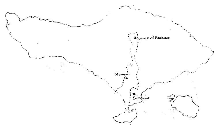
Figure 1. District of Mengwi in the Regency of Badung
- 4. The street patterns were to be generated from the core pattern of pampatan agung or 'great crossroad' that is the physical manifestation of a meeting place between the three worlds. It will be located more or less in the center of the site, hence occupying the central space of the nine-folded spatial division (Bappeda Badung, 1997: III-5) (fig. 2).
- 5. Based upon Lynch's (1960) spatial cognition and to a certain extent, urban design elements, a series of urban design concepts was developed (Bappeda Badung, 1997; III-6 III-9):
a) Landmark
There were three landmarks to be constructed in the area design unit, one was a major landmark and two were local landmark. The major one was a bale kul-kul or drum tower, a means of communication in traditional Bali by which some public messages were transmitted (e.g. messages of public gathering, fire hazard, flood, and the like). Since Bupati offices were acted in a quite similar way, that was conveying messages to mobilize the public within regional development frameworks, a bale kul-kul was a germane representation of a civic center's role (figure 3). The local landmarks consisted of 1) Bima statue, a mythical character in the Balinese folklore who symbolizes strength and toughness, qualities required for governing the regency: and 2) Saraswati statue, a Balinese Hindu goddess of science and wisdom, whose, in this respect, signifies the other qualities required by the government.
b) Node
Node was meant to be transition spots for spatial structure or movement, as such, crossroad patterns were laid out throughout the area design unit to act as nodes.
The design project was to be finished in 150 calendar days and involving public consultation in three occasions. The first when the Preliminary Report was submitted, second when the alternative designs were proposed, and the last when the Final Draft Report was submitted. The public consultation was a kind of small meeting with audience consisted of Local Planning Board (Bappeda) as the project owner, representatives of the Local People Assembly (DPRD), and a small number of invitees (academician, informal leader, and the like). However, minutes of the consultation meetings revealed that there were disagreements on how should the traditional-conceptions be translated into 'modern' site plan and landscape design idioms (Bappeda Badung, 1997). In the end, the allocated project time served as a decider, and the above-mentioned concepts were the consensual outcomes. In other words, the design translation was hastily developed not on a common understanding of centuries old conceptions of space. The following section will offer some evaluation of the concepts against the preceded brief elaboration of the Balinese traditional-religious conceptions of space and the urban design objectives.
V. DISCUSSION
The evaluation of the project will be structured in accordance to the project's proposal of the underlying urban design concepts as presented in the preceding section.
Nine-spaces Site Division
The problematic of designing an area in Bali with an aim of accommodating traditional-religious spatial conceptions, is the definition of a cosmological territorial unit for the purpose of fully applying such conceptions. Such being the case, only by adopting an existing territorial unit system that one can carry on that spatial design task (Samadhi, 2001b,c). The discussed project had this particular problem, since the area design unit is not by any measure an existing cosmological territorial unit - or even acknowledged as a part of one, and had not been intended to be established as one7. Hence, it can be said that the design approach concentrates more on making possible analogies and modifications.
Figure 2. Regency of Badung Civic Center Block Plan
Figure 3. Bale Kul-kul at the Main Crossroad
The site division to coincide with the Sanga Mandala principle was amplified by the street pattern that clearly demarcated a nine-space area structure. With main local streets crisscrossing such that divide the site into nine spaces, the first design objective was captured quite efficiently, that is making every place within the area design unit equally accessible, and thus, responsive.
The grid-like street pattern along with a clear street hierarchy system has always been known as an easy way to produce a comprehensible area structure, and this can also be recognized in the proposed site plan (figure 2). With the help of landscape furniture such as the bale kul-kul, statues, and the like8, the goal of achieving an area design unit that has physical environmental legibility can be met. The designation of pura as the area's worshipping facility in the most cosmological sacred place within the site is another way to serve the population orientation mechanism, and ultimately added up to the overall legibility. As Moughtin et al (1999) argued, legibility is one of the qualities of traditional place or town which made it 'easy to read', and it is one of the qualities that should be sought in an urban design project (Lynch, 1981).
Greenbelt Area
The original concept of the greenbelt area could be, among others, traced back to Ebenezer Howard's Garden City, in which greenbelt areas are needed to limit the physical growth of a designated town area. In the discussed project, it is quite clear that the objective was to represent the concept of 'baby in a womb', or 'the content' protected inside 'the container' which manifested the interrelationship between microcosm and macrocosm. As such, the design concept was a straightforward attempt to physically materialize the Balinese worldview, thus combined with the site division, conveys the desire to achieve the livability derives from the utilization of familiar values.
In a real situation, a cosmological territorial unit is an independent unit that has its own cosmological orientation, which limits the growth of the settlement within the territory of the unit (c.f. Sentosa, 1994). Hence, with or without physical boundaries, the physical growth of such a unit will be limited. As a pseudo cosmological territorial unit, the designed area should obviously utilized physical boundaries to define its territory. This reminds us to the city or town to compose its identity. If by doing so the designed area could establish its identity, then, the third and fourth urban design objectives were fulfilled.
The Micro Planning
The designation of land uses within the site was the consultant's interpretation of the sacred-profane categorization of land -perhaps, more appropriately, building(s)-uses, which expectedly quite a problematic task. First of all, modern land uses tend to be much more complex than the ones addressed by the traditional-religious conceptions such as parahyangan-pawongan-palemahan tripartite which posits temples and sacred sites on one extreme and the cemetery on the other, and the housing areas in between. This is where the aspiration of public came into light as one of the ways to determine or compromise the category of land uses (c.f. Samadhi, 2001b,c). A good approach to this matter should contribute to the production of sense of place. As indicated by Samadhi (2001b), Eiseman (1990), and Nas (1995), the Balinese rely the construction of their familiarity with the surrounding built form by acknowledging the siting of particular elements as indicator of the sacred-profane axes.
In this case, what the consultant did was merely utilizing the nine-spaces pattern as the basis for lying out the land uses, and accounting only the kaja-kangin and puseh (center) as places of predetermined uses. Thus, in a way, the resulting physical form of the area design unit has been designed to facilitate a match between place and the whole pattern of behavior of user group including visitors.
The Crossroad, The Landmarks, and The Nodes
Crossroad has a special meaning for the Balinese Hindu. It is the physical manifestation of a meeting place between the three worlds and all the power from the four directions. However, since the area design unit was not a truly cosmological unit, the objective of constructing a grand crossroad (there will be a swastika-shaped pond surrounding a huge bale kul-kul or drum tower in the middle of this structure) is to create a physical form and structure that is quickly and easily imagined or felt either as a mental pictures or meanings, and as such has the quality of 'imageability' (c.f. Lynch, 1960) and 'contextualness' (c.f. Tibbalds, 1988).
By characteristics, landmark and node have similar functions that are as environmental cues by which one structure his/her mental map and spatial cognition, and for area navigation purposes. Landmarks and nodes that take the advantage of a familiar Balinese settlement element, are to some degree a good strategy to achieve the third and fourth design objectives. However, the failure to define a cosmological unit as a precondition for the 'crossroad' to perform its cosmo-religious duties, has certainly prevented its utilization to fully assist the designed area livability enhancement.
VL CONCLUSION
The project was aimed at producing a site plan for the Badung Regency Civic Center that accommodates the Balinese traditional religious conceptions of space. The result was an attempt of constructing a cosmo-religious landscapes in the hope of contextually connected the urban design proposal with its cultural setting. However, the failure to define the area design unit as a cosmological unit -or part of an existing cosmological unit- as a precondition for such conceptions to be effectively utilized in the first place, has certainly prevented the fully achievement of the underlying goal as stated by the project's terms of reference. Had the area design unit been analyzed as a part of an existing cosmological unit, the outcome would be different, and the cosmoreligious landscapes could well achieved.
VII. REFERENCE
- Bappeda Kabupaten Badung. 1997. Rencana Umum Tata Ruang Kota dengan Kedalaman Rencana Teknik Ruang Kota Kawasan Pusat Pemerintahan Kabupaten Dati II Badung: Buku Rencana. Denpasar: Bappeda Kab. Badung.
- Bappeda Kabupaten Badung. 1997. Berita Acara Pembahasan Draft Rencana RUTRK/ RTRK KPP Kab. Dati II Badung. Denpasar: Bappeda Kab. Bandung.
- Bentley, I., A. Alcock, P. Murrain, S. McGlynn, and G. Smith. 1985. Responsive Environments: A Manual for Designers. Oxford: Butterworth Architecture.
- Crane, David. 1962. The city symbolic. Journal of the American Institute of Planners 26, pp. 280-292
- DHV Consultants BV. 1996. Profil Lingkungan Bali. Denpasar: BUIP.
- Eiseman, Peter J. 1990. Bali: Sekala and Niskala, Vol. 2. Singapore: Periplus Edition.
- Lynch, Kevin. 1960. The Image of the City. Cambridge: The MIT Press.
- Lynch, Kevin. 1981. Good City Form. Cambridge: The MIT Press.
- Moughtin, C., R. Cuesta, C. Sarris, and P. Signorettá. 1999. Urban Design: Method and Techniques. London: Architectural Press.
- Nas, Peter J. 1995. The image of Denpasar: about urban symbolism between tradition and tourism. In Issues in Urban Development: Case Studies from Indonesia, ed. P.J.M. Nas. Leiden: Research School CNWS.
- Relph, Edward. 1976. Place and Placelessness. London: Pion
- Samadhi, T. Nirarta. 2001a. Cultural based town form determinants and the development of Balinese urban design concepts. Jurnal ASPI, 1, (1), pp. 25-39
- Samadhi, T. Nirarta. 2001b. Continuity and Change in the Balinese Urban Areas: A Study of Urban Design as a Means of Achieving a Balinese Town with Cultural Identity. Unpublished doctoral thesis. Royal Melbourne Institute of Technology.
- Samadhi, T. Nirarta. 2001c. The urban design of a Balinese town: placemaking issues in the Balinese urban setting. Habitat International 25, (4), pp. 559-575.
- Sentosa, Lucas S. 1994. Continuity and Change in Balinese Dwelling Environments: A Socio Religious Perspective. Unpublished doctoral thesis. Georgia Institute of Technology.
<sup>1</sup> Atma, sarira, and prana literally mean 'the spirit', 'the vessel' and 'the energy' respectively. These three elements are the ingredient of every cosmos, be that a human being, a village or the universe.
It literally means 'three causes of goodness', with its elements of parahyangan (atma) or god-related objects, pawongan (prana) or human-related objects, and palemahan (sarira) or space. As already mentioned, in a settlement, this philosophy is represented by temples, settlement dwellers, and settlement territory respectively.
<sup>3</sup> Kaja-Kelod means the 'mountainward-seaward' axis, which conotes the sacred-profane dichotomy with the mountainward direction being the sacred (abode of the gods) and seaward direction (where the demons dwell) being the profane. For most of the Balinese towns this axis coincide with north-south axis.
<sup>4</sup> Kangin-Kauh means the 'sunrise-sunset' axis, which represent birth-death dichotomy, where sunrise direction being the 'birth', hence preferable, and sunset direction being the 'death'.
These urban design objectives were developed on the basis of data and information gathered from field studies in the city of Gianyar, Bali, between 1998-1999 (c.f. Samadhi, 2001b), under the presumption that Bali Province is ethnically significantly homogeneous, and so does its cities, these urban design objectives should rightly be applied to any Balinese cities other than Gianyar.
<sup>6</sup> As the Balinese indigenous wind-rose determined by relative position to the mountain, when the kaja direction coincided with north, the most sacred parts will be the ones in the north-easternmost parts of an area.
<sup>7</sup> In my opinion, the complexity - and, perhaps, controversy - of establishing such a territory had prevented the project to do so.
<sup>8</sup> And perhaps, later on, with a conscious architectural design of every building, this objective could be more easily achieved.