
Introduction
Because urbanization and development are intrinsically linked, urbanization puts pressure on existing urban areas to provide increased access to facilities and infrastructure, leading to a redevelopment or regeneration process (Ahuja and Priyadarshini, 2017). It has been recognized that urban renewal or regeneration and sustainability should be combined together (Zheng et al., 2014). To ensure social equity, it is therefore highly recommended to involve local citizens in this planning and decision-making process. Decisions must be based on a combination of technical expertise, rational decision making, and public values and preferences (Petts, 2000). In a participatory process, the local community is considered complementary and mutually supportive to the public and private sector (Shin, 2008). Therefore, for successful and sustainable urban redevelopment planning and implementation, participation of the local community needs to be strategically planned (Ahuja and Priyadarshini, 2017).
In developed countries, the concept of public participation has gone a long way, having become an acceptable component of public decision making (Alterman, 2000). In the last two decades, numerous developing and developed cities have tried to come up with their own models, where citizen participation is common in every stage of the plan making. These models have successfully been applied to capture local needs in several cities and countries, such as Johannesburg (Thwala, 2009), Cairo (Ahmed, 2015), Kenya (McCutcheon and Talyor-Parkins, 2003), the UK (Power, 2008), and Ahmedabad (Annonymous, 2007). These projects had different focus areas based on the project's objectives (i.e. land, housing, infrastructure, culture, etc.).
This study is about community participation towards a redevelopment project in Dhaka, Bangladesh. The part of this city that had our interest is highly populated, historical and commercial. Because of the presence of these three distinct features (high density, high commercial activity and heritage), redevelopment of this area requires consideration from multiple points of view. While demolition is often considered to solve problems arising from a high density of old buildings, Power (2008) mentions the social, economic and environmental benefits of refurbishment compared to demolition in the UK. Moreover, a broad contribution to cultural heritage can create sustainable urban regeneration (Tweed and Sutherland, 2007). A case study in Romania (Ristea et al., 2010) has some similarity, as it dealt with commercial disparities and city expansion and the historical center of towns. The study emphasized consistent thinking, acting and getting local citizens involved with the planning process. With an understanding of the above literature, this paper emphasizes perceiving the local context, involving people in the regeneration process in different ways, and highlighting implications for areas in a similar context.
The next section demonstrates the rationale and objectives of this study. This is followed by a discussion of the different methodologies employed and the data collection procedure. The subsequent section represents the way the author explored the study area using different techniques. The last two sections discuss the results and implications of the current study and conclude this paper, respectively.
Dhaka, the capital of Bangladesh has been experiencing an enormous urbanization process for the last couple of decades. Urbanization is a global trend, as more than fifty percent of the global population is now urban and its rate is increasing with time (World Bank and BCAS, 1998; Zaman et al., 2010). Dhaka is also lifted with this tide, but as a result of developing in an unplanned and disintegrated fashion, Dhaka has been a burden for the country for a long time. Old Dhaka, often called Puran Dhaka, is the oldest and most densely populated part of the city. Taking advantage of water transportation by the river Buriganga, this historical city center has served the country's trade for a very long time. To date, the whole country depends on its wholesale business. Moreover, it bears the signature of many historical buildings, monuments, forts from the British reign and even from the Mughal reign. Whereas the population density of greater Dhaka is 28,000 people per square kilometer (BBS, 2015) (78 times higher than the USA), the density of Old Dhaka, particularly the Central Jail area, is even 143,809 people per square kilometer (BBS, 2015). This area suffers from low urban living standards with poor transport and drainage systems, old earthquake-prone buildings, hazardous industrial activities, lack of open space, traffic congestion and dense fire-prone plots. Although the city is being developed through many urban consolidation projects by private initiatives in many areas (Zaman and Lau, 2000), areas like Old Dhaka with poor accessibility to the road network and other infrastructural facilities does not attract the attention of private developers (Islam 2009). The present trend of land development is twofold: expanding peripheral areas and intensified inner development by vertical expansion. Since 1951, the expansion of the city's urban area and population has never been done in a planned manner (Islam et al, 2009).
The Central Jail in Old Dhaka (built in 1638) used to be the largest jail in Bangladesh. In July 2016, it was moved to another place, called Keraniganj. Hence, a huge area of 36.76 acres became vacant and opened up the possibility to turn the area into a public place. The alteration of land use into public space is expected to have a positive impact on the surrounding area (Song et al., 2016). In an extremely tight place like Old Dhaka, the future land use of the former jail area must be carefully assigned. Thus, a wave of redevelopment in the surrounding area is very plausible. In Dhaka, particularly in its old part, many public spaces were lost or have been neglected. (Mowla, 2012). The Central Jail area is such a space, but like many other government projects, there is a very high likelihood that projects will be launched that are more driven by personal or group interests and for political benefit rather than focusing on the local people's need and expectations. A participatory approach is very useful for developing scenarios that are more inclusive towards the different minority groups of citizens as well as stimulating interaction between local people and organizations (Mascarenhas, 1991). Likewise, this study also portrays the microscale reality of this area in the light of redevelopment, which has been overlooked in many large-scale projects, remaining hidden under a large amount of data, number and statistics.
Redevelopment of old Dhaka is an emerging issue to be solved with a participatory approach (Daisy et al., n.d.). Fifty percent of old Dhaka's area has the potential for redevelopment instead of urban renewal (Islam et al., 2009). Therefore, this study attempted to look at the top issues to be solved prior to redevelopment in order to formulate recommendations with a blend of planners' views and people's opinions. In small-scale planning, depending solely on national data is often misleading as many local aspirations and observations will be overlooked. Thus, the objectives of this study were:
- 1. To find out the physical and socio-economic characteristics of the surrounding areas of Dhaka's Central Jail area.
- 2. To explore persistent problems, analyze their causes and effects, and implications for the redevelopment process.
- 3. To evaluate the efficacy of the participatory approaches used and to highlight general implications for similar future research.
For redevelopment, revitalization or consolidation works in Old Dhaka there are couple of interrelated often contradictory issues that require steady and patient discussion with the local people. It is a very dense area, a trade hub with cultural sentiment, and a historic place with earthquake-prone buildings. To deal with these multiaxial issues, the Participatory Rural Appraisal (PRA) method fits best. PRA is more empowering and involves an outsider as catalyst and convener who enables local people to undertake and share their own investigations and analysis (Chambers 1994). Of the three basic models of community participation suggested by Vraneski (2002), one is 'third-party', which refers to engagement through initiatives of agents of change, which best describes the role of the authors in this study. The research team comprised of students and faculty members of Bangladesh University of Engineering and Technology. The vision of this study was to generate evidential recommendations to support any redevelopment project for this area.
Method
As this study aimed to create a strong foundation for initiating a redevelopment process, we ensured public participation from the very first stage of this process. In this respect, this study followed a participatory approach to ensure community participation, enhancing the quality and reliability of the findings greatly. The overall working procedure was to collect both primary and secondary data. Different methods were used for different contexts. The method of community participation needs to be planned beforehand to reflect the community profile and the nature of the project. Here, we used a combination of methods. Firstly, to understand the local context, environment, dynamics, culture and people, a historical timeline was made, which was followed by a transact walk, preparing a social and physical map, and a mobility map. In every stage, local people and institutions were involved. Secondly, to obtain the second objective, a number of other PRA techniques, i.e. pair-wise ranking, a cause effect diagram, and a SWOT analysis, were carried out. In this stage, again, local participation and focus group
discussions (FGD) administered by the author played an important role. Then the output of these methods was summarized as input for future redevelopment projects. Thirdly, the efficacy of using this combination of different methods was evaluated and general lessons were formulated for similar contexts in the developing world. As we used a combination of different methods, it is necessary to discuss the rationale for choosing this set of methods.
Participatory approaches have been followed and recommended for urban redevelopment/ regeneration/renewal processes worldwide (Roshanali, 2018; Dobbs and Moore, 2002). Purcell (2009) emphasizea mapping and photography for community participation in the redevelopment process. Kalibo and Mendeley (2007) used a historical timeline and a transact walk for a project to promote collaborative management in Kenya. The transact walk, where the researcher and key informants conduct a walking tour through areas of interest to observe, to listen, and to identify different zones or conditions, is a great tool for getting a preliminary understanding if the very local context of the area of redevelopment is not known to the researcher/planner (Cavestro, 2003). Pair-wise ranking helps greatly to set priorities (i.e. problems, needs). Yau and Chen (2008) used pair-wise ranking in a participatory approach for redevelopment in Hong Kong. SWOT analysis is another effective tool, which contributed greatly to a regeneration project in Coimbra (Vicente et al., 2015).
Each of these tools has their own functionality and merits in different cases. PRA approaches fit differently with big- or small-scale projects in blight areas, historical areas, rural areas, riveroriented areas, etc. For our study, considering the psychology of people who live in a historical area, their tradition, their density, their previous interactions and conflicts with government officials, we developed the methodological framework that comprises the above-mentioned tools. The timeframe of conducting this research was limited and the number of surveyors/facilitators was also limited. Keeping all this in mind, making a historical timeline, doing a transact walk, social and resource mapping, and mobility mapping was selected to get an understanding of the locality and to establish a connection with the local community. This helped greatly to form focus groups and conduct the discussions in the second stage, where problems were identified and discussed in great detail. This blend of methods helped to initiate and operate the research, to engage people and to generate output efficiently.
Data for this research were collected in three ways. We had a guided walk in the streets and had conversations with many random people. We visited old houses, where we talked with elderly people to know their experience and also with young people to understand their perception of the problems. The collected data were mostly in the form of a qualitative write up and maps. With these data we gained an initial understanding of the issues in the area and we confidently moved to the next stage, involving local people in the identification of the problems, their causes and effects. The last way to collect data was focus group discussion. It enabled us to end up with some strong insight about the solutions and strength, opportunities, weaknesses and threats in achieving them. The stepwise methodology is described in detail below.
First a base map was collected from a secondary source: the Detailed Area Plan (DAP) 2006, Rajdhani Unnayan Kartripakkha (RAJUK). Then a historical timeline of the area was prepared based on both primary and secondary sources. The rest of the information was then collected through a primary survey, particularly using PRA tools.
The social and physical resource map is a PRA tool that enables individuals to share and assess their local knowledge and to act accordingly (Chambers, 1994 and Kumar, 2002) without any outsider influencing the process (Alam et al, 2012). It encourages local participation in planning and represents the stakeholders' desire and targets (Madon et al, 2018). First, five social groups (cultural, merchant committees) were selected, involving people of different ages and different classes (Figure 1(a)). There were 36 members in the committees during the preparation of the resources map. They were provided a map of the Begum Bazar area. To make the map easier to understand to them, a clear explanation of the map was given. Then, they were asked to name the social and physicals resources of the area. Social mapping is a graphical representation of the social and physical features and the natural resources in a community (Kumar, 2002; Kathirvel et al., 2012; Crane et al., 2003). The participants then located all the social and physical resources in the area. They had a clear idea of the resources in the area. Two axial sections were taken to do a transact walk, through which the information of building height, activity level, and main land use in the area were brought out. A transect walk is another PRA tool, done by walking with local people and asking, discussing, and observing local issues (Chambers, 1994). It provides a cross-sectional representation by observing, asking, listening, seeking opportunities and recognizing the challenges in an area for improvement (Kumar, 2002). A mobility map was devised and business zones were identified based on the transact walk (Figure 1(b)). In total, five focus group discussions were held before coming to this stage.
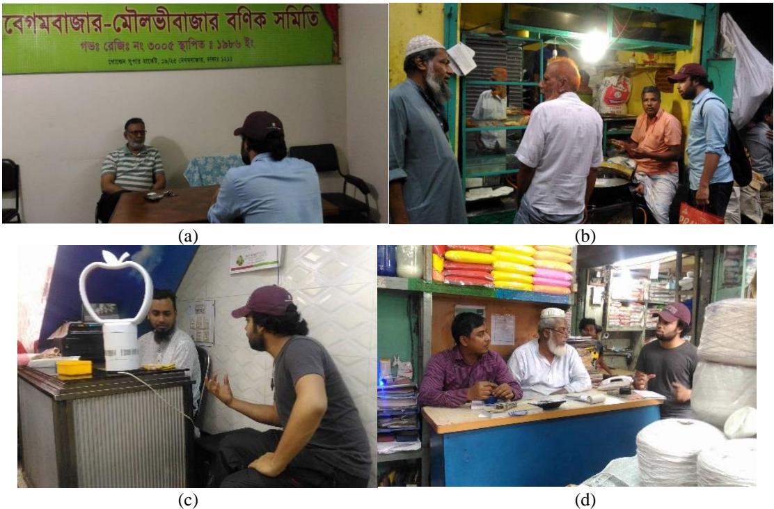
Figure 1. (a) Meeting with the chairman of a local merchant committee (Panchayat), (b) talking with people during the transact walk, (c) and (d) participatory discussion to gather local perceptions.
After identifying the general problems, we went for a pair-wise ranking with the participation of 18 local people from different income classes. Pair-wise ranking is also known as matrix scoring and ranking (Chambers, 1994; Cavestro, 2003). Then a cause-effect diagram was produced and a SWOT analysis was done after five successful focus group discussions. After completion of the collection of all relevant information on the problems and strengths of the area, a number of proposals were made. The proposals were mainly the reflection of the expectations of the people who are part of the local community (Figure 1(c), 1(d)). Major
emphasis was put on readjustment of the area. A proposal on the use of the Central Jail area was recommended, which was also carried out through a primary survey among local people.
Study Area
The study area (Figure 2) is Begumbazar-Moulovibazar in Old Dhaka, which is located at the south east of the former central jail of Bangladesh. It is bounded by Naya Bajar in the north and Shoari Ghat in the south. Abul Khairat Road and Mitford College Road (water works road) and Babu Bazar Bridge Road are the main bounding roads of the site. This area is right next to the former jail and has many important wholesale business shops. The area is under the jurisdiction of Dhaka South City Corporation (DSCC), Ward 69. After the liberation war of 1971, development activity gained pace. Electricity, telephone, water connections are well operated here, along with gas connections. However, due to the high density and the proximity of buildings, installing and repairing works of these utility lines is complex. Because of the high density and the increasing number of high buildings (Figure 3), many other consequential problems arise. The high density puts extra pressure on the narrow roads. Light and air ventilation systems of buildings deteriorate gradually. Some of the roads have been developed in the last few years, but they were not widened. Rather, many drainage lines were drawn over the streets, making them even narrower.
The major land use in the study area is mixed use, especially as a busy commercial hub of versatile wholesale businesses. In Figure 4, some areas are shown with the dominating type of business. The areas that do not fall in any category are mixed development along with residential land use or other social, recreational use and mixed commercial use.
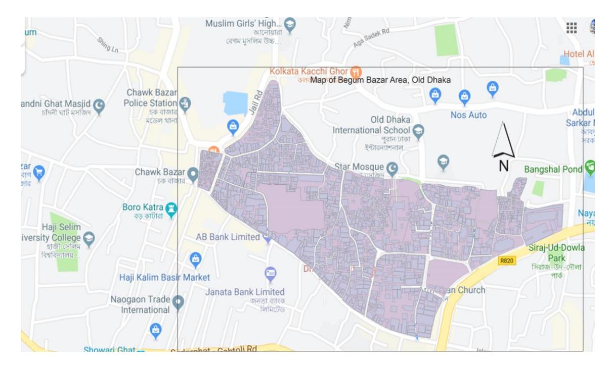
Figure 2. Study area.
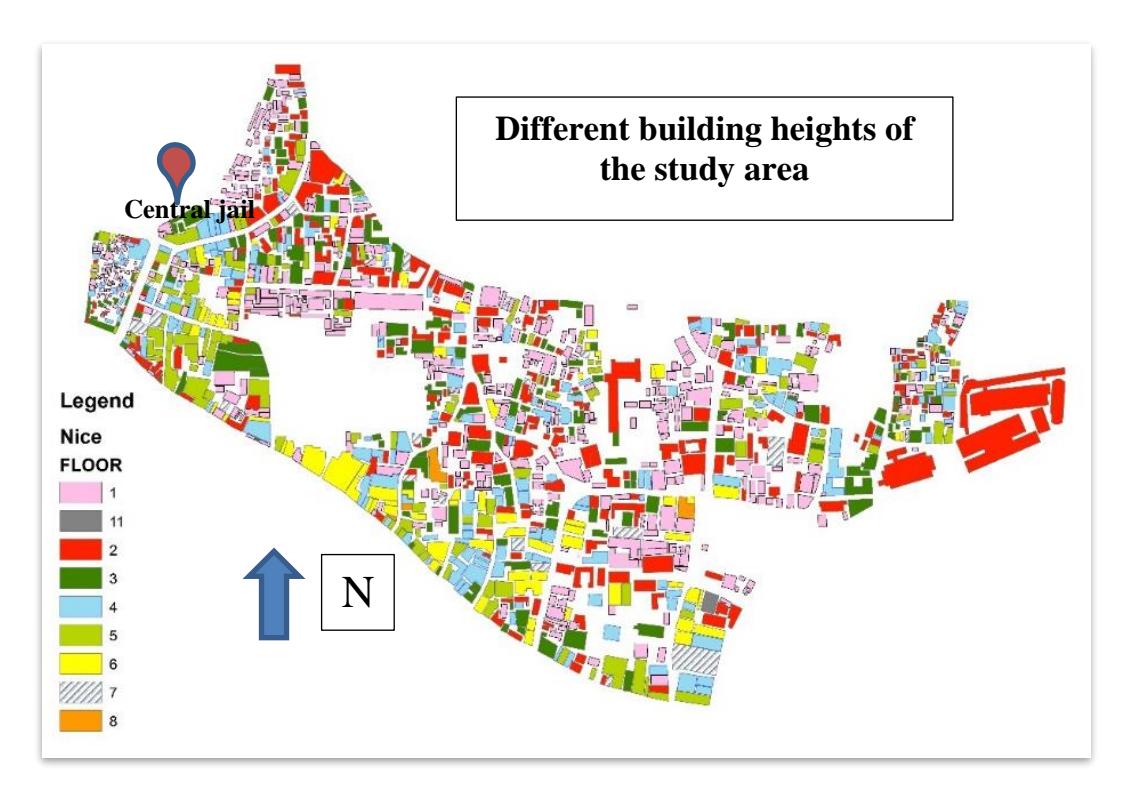
Figure 3. Heights of different buildings in the study area.
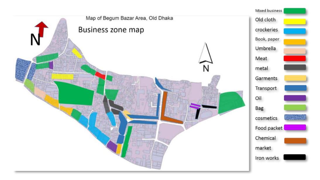
Figure 4. Locations of different type of businesses.
The most significant hub is formed by the chemical industries here, which should not be located in such a residential-commercial area. The area is vulnerable to fire hazards; several accidental fire outbursts in Chawkbazar have led to renovations and reconstructions in the area (Huq, 2016). There are some significant social and physical resources as well. There are 11 mosques, numerous restaurants, more than twenty banks, five schools, one residential hostel, one church, one library, one shamittee (neighborhood committee) in the area (Figure 5).
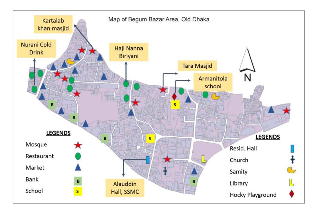
Figure 5. Social and physical features of the study area.
Knowing the history of the area helps a lot in the planning process to think with empathy, to know what local people value and to come up with compatible policies. Although much information was not found about this specific study area, the retrieved information helped us to talk with local people with confidence. Through the transact walk, this study constructed the following historical timeline.
1700-1704: Construction of Murshidkuli Kha mosque
1739: Renamed Begum Bazar Masjid after Murshidkuli's daughter
1825 (apprx): Tara Mosjid was constructed 1833: Official launch of the central jail 1904: Armanitola High School established 1905: Armanitola Hockey Society established
1925: Another primary school named Mahuttuli Primary School established; the educational system in this region was developed after World War I
1926: Tara Mosjid redesigned and an extension constructed
1928: Sobhan Monjil, one of the former luxurious residential buildings in this area
constructed
1950-1960: Electricity and water supply system developed
Before 1971: Mostly building tin-shed
After 1971: Concrete structured housing building practice started gradually
1986: Establishment of Begum Bazar – Moulovi Bazar Banik Samiti: one of the leading cooperatives in this business hub
2000 (appx): Three- to five-story buildings 2002 (appx): Declination of porcelain works
2011: Al Falah Market established, one of the largest markets in the region 2014: Modina Asik Tower established, another multiple story market.
To analyze the traffic patterns, the 13 main roads in the area were inspected (Table 1). They were categorized in two ways according to the width of the road and the type of traffic flowing through. One is Category A (15 ft to 18 ft wide) and the other is Category B (8 ft to 12 ft wide). Most of the roads face a high volume of traffic flow every day (Figure 6, 7). A mobility map was prepared by combining the author's visual inspection with local people's views.
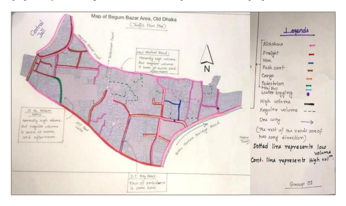
Figure 6. Mobility map of the study area (prepared by local participants, administered by the author).
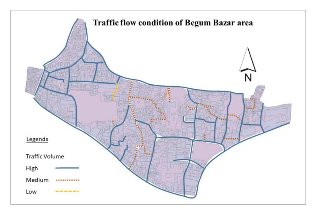
Figure 7. Traffic flow map of the study area.
Table 1. Traffic flow conditions in Begum Bazar area.
| Sl. No. | Road | Traffic volume | Time | Composition of traffic | Major traffic | Major purpose | Participant |
|---|---|---|---|---|---|---|---|
| 1 | Begumbazar road | High | Whole day | Rickshaw, van, pushcart | Rickshaw | Goods transport | Md. Abdul Gofran |
| 2 | Abul Khairat Road | High | Morning and evening | Rickshaw, motor bike | Rickshaw | Passenger transport | Kyum Hasan |
| 3 | Abul Khairat Road | Regular | Noon and afternoon | Rickshaw, motor bike | Rickshaw | Passenger transport | Kyum Hasan |
| 4 | Amanitola Road | High | Morning and evening | Cargo truck, rickshaw, van, pushcart, car, motor bike, truck | Cargo truck and truck | Goods transport | Forman Mia |
| 5 | Babubazar Bridge Road | High | Morning, afternoon and evening | Minibus, truck, car, CNG, rickshaw, cargo truck | Minibus | Passenger transport | Rifat Mollah |
| 6 | Jailkhana Road | High | Morning, evening | Rickshaw, Motor bike, car, van | Rickshaw | Passenger transport | Arman Hossain |
| 7 | DC Ray Road | High | Whole day | Pushcart, van, rickshaw | Van | Goods transport | Safar mia |
| 8 | 79 Moulavibazar Road | High | Noon and evening | Rickshaw, van, pushcart, | Pushcart | Goods transport | Adbul Sattor |
| 9 | Rajani Bose Lane | High | Whole day | Cargo truck, ambulance, rickshaw, van, motorbike | Cargo truck | Goods transport | Md. Zafor |
| 10 | Becharam Dewri Road | Low | Whole day | Rickshaw, van, motor bike | Rickshaw | Passenger transport | Kyum Hasan |
| 11 | No. 36 Moulovibazar Road | High | Whole day | Rickshaw, van, pushcart | Rickshaw | Goods transport | Md. Abdul Gofran |
| 12 | 13 No. Mokim Katra Road | High | Morning and Evening | Pedestrian, rickshaw, van | Pedestrian | Goods transport | Md. Goni Mia |
| 13 | Chalk Circular Road | High | Whole day | Rickshaw, van, pushcart, cargo truck | Rickshaw | Both | Md. Nur Islam |
Result and Discussion
After conducting FGD with several merchants, cultural and casual groups, the key problems were identified. These included poor drainage (Figure 8 (a), (b), (c)), narrow roads, unsafe buildings (Figure 8 (e)), hazardous roads (Figure 8 (d), uncovered bins and open dumping of waste in the street (Figure 8 (i), (j)). The participants discussed the problems while the facilitator carefully kept the discussion on the planning track. Subsequently, the problems were prioritized using a pair-wise matrix (Table 2). With community participation, three top problems were selected, i.e. poor drainage, narrow roads and existence of chemical industry.
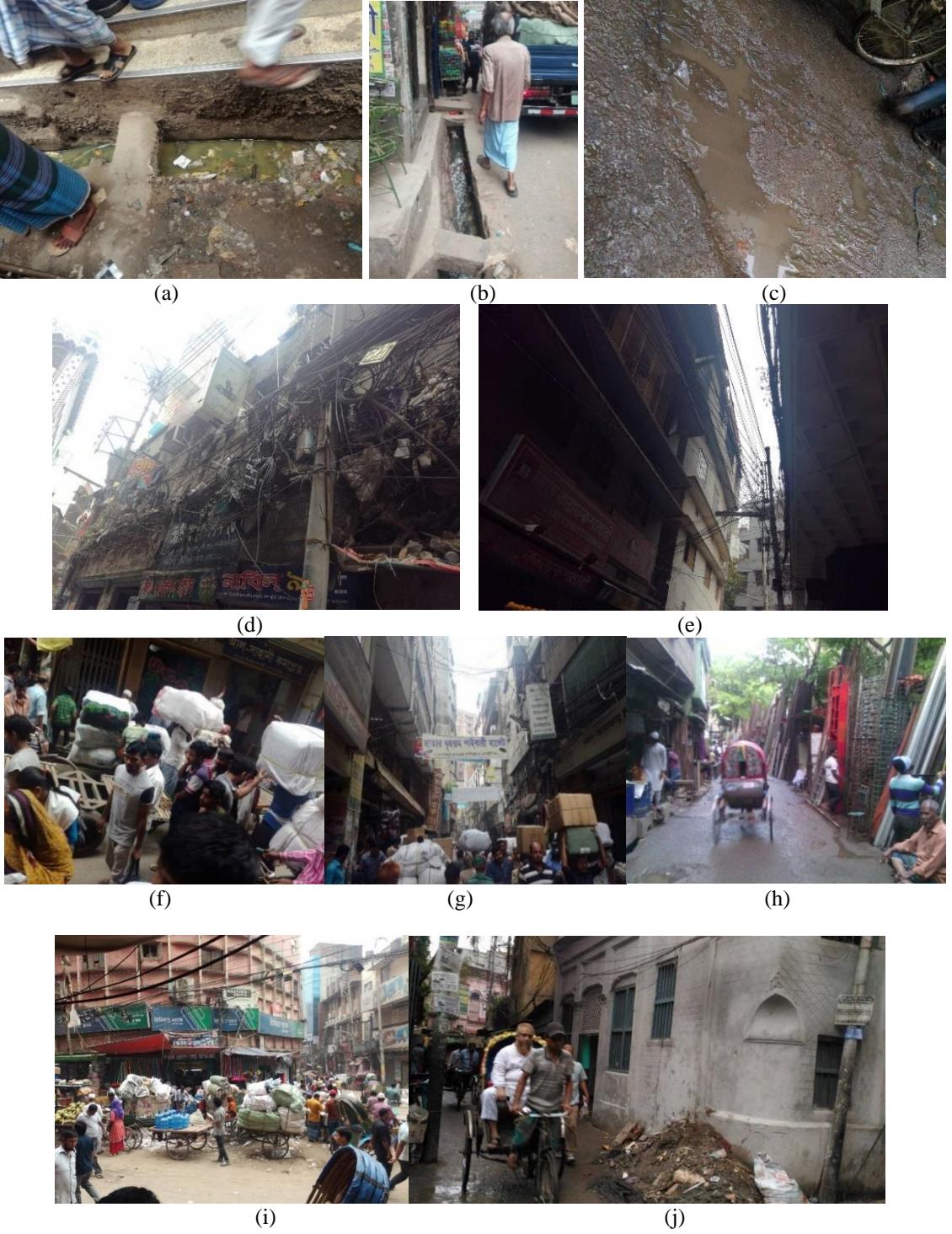
Figure 8 (a), (b), (c): Poor drainage (d), (e): unsafe, earthquake-prone and hazardous buildings and road conditions, (f),(g) narrow and (h) hazardous roads. (i), (j): Uncovered bins and open dumping of waste. (Source: author)
| Poor Drainage (PD) | M) Chemical Market (C | Uncovered bin (UB) | Narrow Road (NR) | Lack of open space (LoOS) | building (CB) Congested | Unusual mix of MoLU) land use (U | facilities (LoCF) community Lack of | disposal system Lack of waste WDS) (Lo | Total count | Rank | |
|---|---|---|---|---|---|---|---|---|---|---|---|
| PD | PD | PD | NR | PD | PD | PD | PD | PD | 7 | 2 | |
| NR | CM | CM | CM | CM | CM | CM | CM | 6 | 3 | ||
| UB | NR | UB | UB | UMoLU | UB | UB | 4 | 5 | |||
| SoW | NR | NR | NR | NR | NR | 8 | 1 | ||||
| LoOS | LoOS | LoOS | LoOS | LoOS | 5 | 4 | |||||
| CB | UMoLU | LoCF | CB | 1 | 8 | ||||||
| UMoLD | UMoL | LoWDS | 3 | 6 | |||||||
| U | |||||||||||
| LoCE | LoWDS | 0 | 9 | ||||||||
| LoWDS | 2 | 7 | |||||||||
| Total | 1 | 2 | 3 | 4 | 5 | 6 | 7 | 8 | 36 | 36 |
Table 2. Pair-wise matrix and ranking.
These problems were then analyzed using a cause-effect diagram (Table 3). When the causes and effects were discussed with the local participants in a guided way, many misconceptions about the problems were eradicated so it became easier for them to come out with solutions rather than responding to questions like: "How can the problems be removed?" The local people came with feasible solutions. They have suffered for a very long time from the inconvenience of the narrow roads. Begum Bazar is a busy commercial area with multimodal traffic for loading and unloading activities. Rickshaws are the major traffic mode on the roads of the area. On some roads, heavy vehicles such as cargo trucks, trucks etc. are also operated, although the roads are not wide enough. Most of the roads are narrow, with a width smaller than 5 feet. Many of them have access roads to buildings. There are some roads ranging from 8 feet to 15 feet where lots of traffic moves through all day long. Islam (2009) found that the average access road is 3.03 meter while the main road is 19.6 meter. As a result, there is traffic congestion on almost all the roads all day long. Thus, there is an urgent need to widen the roads, which is difficult to fulfill. Moreover, along most of the narrow roads highrise buildings have been constructed, for example Begum Bazar Road, D.C. Roy Road, Rajani Bose Lane, Kasaituli Lane, Moulavibazar Road, and Mitfort Road. The local people think it is not possible to negotiate with the owners of the buildings to widen the roads. But there are some roads that can be widened, i.e. Central Jail Road, Abul Khairat Road and Armanitola Road, indicated on the map with a red line (Figure 9). These roads are not too narrow, but the traffic volume is too high. Along Armanitola Road there are many transport agencies and their cargo trucks reduce the effective width of the road.
Most of the buildings along the Central Jail Road have one story and the building density is also low along the road. Thus, the people from the area believe it is possible to negotiate with the land owners to widen the road. This confirms the study of Islam (2009), which assumed that many one- and two-story buildings are listed for demolition for redevelopment. Abul Khairat Road can also be widened as the Armanitola playground is located to the south side of the road. It can be widened by breaking the wall of the playground. Armanitola Road can be widened as most of the buildings along the road have one or two stories and they are very old. At the eastern part of the road there is Salimullah Medical College's playground. The road can be widened by negotiating with the playground authority and the owners of the adjacent buildings.
Table 3. Cause effect diagram of top-three problems.
| Problem 1 | |||||||||
|---|---|---|---|---|---|---|---|---|---|
| Effects | Vehicular congestion | Interrupted pedestrian and emergency vehicle access | Lack of light and air | Loss of time and resources | |||||
| Problems | Narrow road | ||||||||
| Cause | Unplanned development | Loading and unloading of commercial goods | Haphazard construction work | Waste dumping | |||||
| Problem 2 | |||||||||
| Effects | Water logging | Overflow of human waste | Accident | Environmental degradation | |||||
| Problems | Poor drainage | ||||||||
| Cause | Dumping solid waste | Sewerage connection | Uncovered drains | Poor maintenance | |||||
| Problem 3 | |||||||||
| Effects | Health hazard | Fire hazard of combustible chemical material | Open disposal of chemical waste | Air quality degradation of the associated area | |||||
| Problems | Unplanned and unregulated functioning of chemical industry | ||||||||
| Cause | Illegal and unplanned development of warehouses | Supply of raw materials to industries located nearby | Easy distribution channel due to abundance of transport agencies in the area | Disobeying land use and safety regulations for the chemical industry | |||||
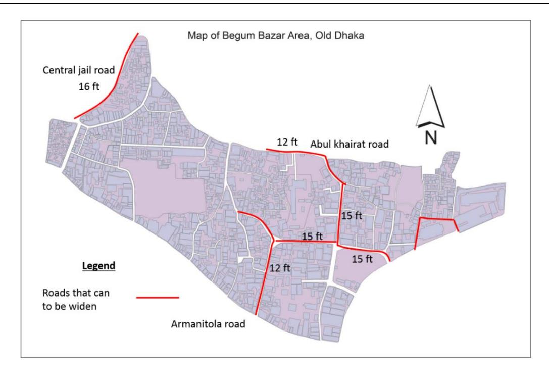
Figure 9. Roads for potential widening.
The drainage problem is not as difficult to solve as the problem with narrow roads. The people of the area want the drainage lines to be reestablished and widened. There are two roads where water is logged if it rains for a long time, i.e. Armanitola Road and Kasaituli Lane (Figure 10). This is because the roads are in the lower part of the area and there is no drainage line along the roads. As a result, the rainwater cannot be discharged. The establishment of a drainage line along the roads is proposed.
Figure 10. Road with water logging problem.
However, the chemical market and its associated syndicate is a very hard nut to crack. Because of the well supply and distribution channels, merchants find it a suitable location to establish themselves, but they overlook the risk hazard. Because of weak regulations from the authorities, owners are still exposing the residential communities to various health hazards. Communicating with both the local people and the owners of the chemical industry together, a solution has been found where only the warehouses would be shifted from their existing location to Beribadh (3.5 km away from the study area). The owners do not want to move the market to another location because it would lead great losses of business as people are familiar with the location. They fear that if the market is moved, competitors might contact their customers to send chemicals from their country shop with cargo trucks.
SWOT Analysis
SWOT (Strength, Weakness, Opportunity and Threat) analysis is an effective analytical tool for urban development projects (Halla, 2007, Mubarak, 2010, Pandya, 2017). It was used in this study after analyzing the ideas of the local people in FGDs, which were represented in a causeeffect diagram and the planning practices and frameworks of Dhaka city.
Strengths: The main strengths are the interests of a portion of the local people. Small plot size owners are interested in land consolidation. As there are a lot of small buildings in the area, some owners, particularly of very old, outdated, and disaster-prone buildings, are very much
interested in redevelopment. Land consolidation is a prime consideration and there are some roads that can be widened. However, before going through the planning process, additional land-use and cartographic studies are needed along with detailed discussions with local stakeholders.
Weaknesses: Internal negative factors such as multiple ownership of single buildings are a very acute problem here. For land consolidation it is important to convince all the owners, which is very difficult in the case of multiple owners of single buildings. Many plots on which people live are accessed by narrow roads of 3 to 5 feet. For land redevelopment, these roads need to be widened or all the plots with access roads need to be redesigned by providing a wide access road for emergency services such as the fire brigade and ambulances. However, many people do not feel the necessity of this, as they are accustomed to these roads. Many people, especially older ones, are afraid to see changes in their environment as this will affect the essence of old Dhaka. Literacy is another problem that makes it difficult for external facilitators to convince them and could even lead to a public movement against redevelopment. People are often afraid of unfair readjustment and unplanned development. They think that politicians and rich people will claim ownership of large parcels of land. Besides the narrow roads, newly built highrise buildings are another stumbling block in the way of redevelopment in the study area. There are already some new buildings that have been constructed in recent years. Because of land consolidation, they could be destroyed, which would mean big financial losses. There are many retail businessmen, such as chemical good sellers, who have go-downs and shops in the area. They are not willing to move to another location in case of redevelopment of the area.
Opportunities: Redevelopment would create several opportunities. The government is very interested in redevelopment, which will help the work of land consolidation to a great extent. In the new proposal in the Detailed Area Plan (DAP), the issue of redevelopment of Old Dhaka has been highlighted already. There are possibilities of the participation of international developers to remold the area in a more organized way. This will create the possibility of an increase in land value after redevelopment, which will be beneficent for local land owners.
Threats: There is a possibility of new groups of people entering, who are incompatible with the local culture and heritage. Moreover, if the development is not regulated properly or is politically biased, it can affect the neighborhood to a great extent.
Local Aspiration for Redevelopment
Because of the prospect of overall redevelopment, the local people were asked to reflect upon the complexities of negotiating with the multistory building owners, the big merchants' groups, and others industrialists. They pointed at four areas where the plot sizes are small and most of the buildings have one or two stories. Among the four areas, two areas are located along both sides of Begum Bazar Road; one is on Becharam Deuri Road and the other one is next to Kasaotuli Road. The four locations are shown in the following map, indicated by red borders (Figure 11). They also suggested very old buildings to be redeveloped; the locations of these old buildings are shown using blue ovals. There are three earthquake-prone buildings that need to be demolished, as shown using red stars. Redevelopment of these buildings is also possible. The local people believe that financial support from the government with a low interest rate is more acceptable than developer companies. For the land use of the former Central Jail plot, their expectations are: a park for children, 2 girls' schools, a branch of any reputed combined secondary school, 2 community centers and pathways.
Figure 11. Potential area, buildings according to focus group discussion.
Implications of this Study
This study offers significant findings for local policy makers, researchers and planners. For researchers or policy makers globally, we highlight two major implications: one is methodological and the other is contextual. The methodology used in this case was designed in keeping with the distinct and unique nature of the area (a historical, old, commercial hub with traditional people) and the nature of the project (time, cost and number of researchers). The method of community participation needs to reflect the community profile and the nature of the project (Ahuja and Priyadarshini, 2017). This combination of methods was very efficient in capturing the local context, problems, and perceptions; to discuss deliberatively, inclusively and in detail; and to complete the project, yielding results within the limited project time. This case study, therefore, indicates that the local context should be considered first in deciding the methodology and at the same time advocates for the use of the tools employed in this study in order to achieve results in an efficient manner. Pair-wise ranking in particular helped us greatly to select the top problems out of many options. The FGDs were excellent and contributed greatly to the formulation of local recommendations.
From a contextual point of view, one implication for similar studies is to focus on prominent issues but not to ignore the details. We dealt with many difficult issues, such as high density, the traditional mind set of living in a joint family, political unrest, merchant syndicates and corruption. Coming to a single point of view is sometimes very hard to do. In dense areas, where urban consolidation is confronted by many issues, focusing on the most prominent problems and giving the people's preferences priority are keys to reaching a well-accepted solution.
Conclusion
Urban redevelopment is an effective tool to work with old or blighted areas that need to be revitalized. In regeneration areas, equitable access for residents is necessary to enjoy the social benefits of social infrastructure (Brown and Barber, 2012). However, regeneration/redevelopment does not always fit local needs. Therefore, planners should promote the importance of a better understanding of how people interact with the urban environment and its heritage (Tweed Sutherland, 2007). This study employed a participatory approach to find prospects and local issues prior to redevelopment of Old Dhaka. Most of the development works in Dhaka have taken place without considering neighborhood context (Islam et al., 2009). Revitalizing the Central Jail area as a public place or something else is certainly going to bring about vast changes in the adjacent areas. People living in the area are interested in support from the government to rearrange themselves and they are always ready to help the government in implementing any plan that is beneficial to them. This research found that the prospects of redevelopment in the surrounding areas are compatible with revitalization of the Central Jail area. It used several PRA tools, such as preparing a historical timeline, a social and physical resource map, a mobility map etc. to understand the local situation. Furthermore, using pairwise ranking, a cause-effect diagram and a SWOT analysis, critical, persisting problems and acceptable solutions were explored. By offering important local implications and detailed insight for policy makers, it also offers general implications for readers globally. Projects for historical or old cities should care about what the inhabitants value. Projects for cities with high density need to think critically and holistically about all the necessary urban facilities. Projects for revitalization of commercial cities should also think about people's safety, compatibility of different land uses and business impacts. As the ultimate goal of redevelopment projects is to ensure sustainability, this study formulated recommendations for putting the local people, economy and environment at the center of the discussion.